NationalMap is an online map-based tool. It allows easy access to spatial data from Australian government agencies. Various datasets can be overlaid and explored on the map.
The National Archives of Australia collects, preserves and provides access to Government records. Many records are available online for professional research or personal interest.
The Australian Dictionary of Biography contains biographical information on over 13,000 people. It is a useful source of historical information on notable Australians.
Map Search allows layering of various historical Australian maps over current maps. It provides an interactive way of exploring how places have changed over time.
Design & Art Australia Online contains data about Australian artists, designers, craftspeople and curators.
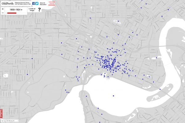
Navigate through space and time with the OldPerth project created in cooperation with Curtin University HIVE.
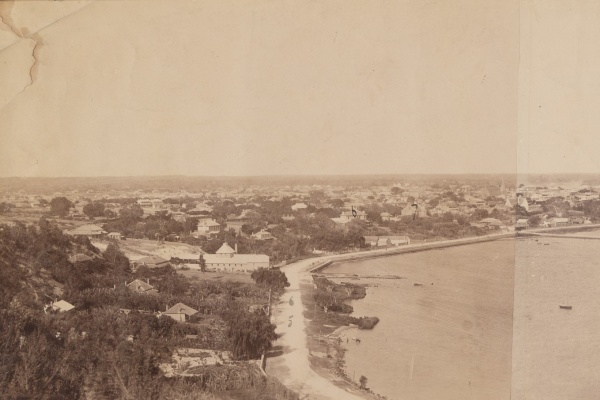
Historical Panoramas features panoramic photographs of Perth and Fremantle. These panoramas show how Perth has developed over a period of more than 150 years.
SCSA's pages on the senior school WA curriculum is a helpful source of information for students studying for ATAR or WACE qualifications.

LibraryCraft allow for various styles of gameplay as single or multiplayer.
The Atlas of Living Australia is an online database of Australian biodiversity. It includes education resources, interactive maps and citizen science projects.
Khan Academy produces short video lessons, and includes practice exercises and materials for educators. All resources are free.

Duolingo is a language-learning website and mobile app. Through bit-size lessons, it makes learning a language fun.