
Maps, plans & charts
The State Library aims to collect a copy of every new map and chart produced in Western Australia and is a legal deposit library for all Government and private publishers. The extensive collection of original cartographic and nautical charts by early Dutch and French explorers, the first surveys of the Swan River Colony, architectural plans and drawings produced by Lands & Surveys, Public Works, Government Railways, and other federal and state government agencies. There are over 44,000 sheets held in the collection, including print, hand-drawn and digital editions.
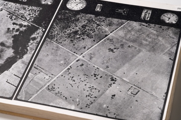
Aerial photographic maps
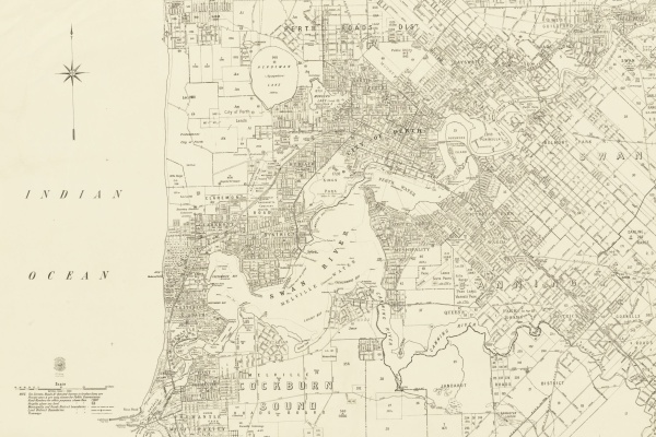
The Battye Library holds several aerial photograph sequences (CN15 & CN16/1 & CN16/2). Aerial photographic maps can help track changes in an area. For example, in late 1940s and 1950s, the Department of Lands and Surveys (Landgate) carried out an aerial survey of Perth showing houses and buildings there at the time, from the air.
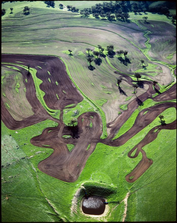
Aerial photograph of ploughed land and a farm dam near Northam 1988
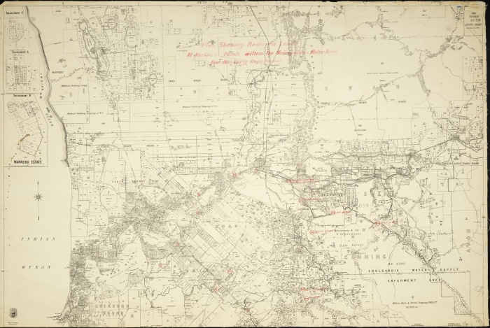
Cadastral maps
Cadastral maps show the boundaries of land, often with areas of individual land parcels for describing ownership. These maps may also depict other features relating to land use and value. Produced by WA’s Lands and Surveys Department from c1910 to the 1960s (CN77). Known as chain series (Bonnes projection), because they are based upon the imperial measurement - the chain.
80 chains equal 1 mile or 1.6 kilometres. The 80 chain series is fully digitised and has the greatest coverage across Western Australia. The 240, 300, 800 chain series covers most of WA. With 4, 20 and 40 chains available for the Perth metropolitan area.
Index to Western Australian mapping of the Bonnes series: 300 series [1:237 600]; 80 chain (1 mile) series [1:63 360]; 800 chain (10 mile) series [1:633 600]; 10 mile topographical series [1:633 600]; 40 chain [1:31 680] series.
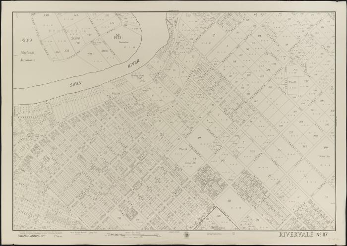
Western Australia Bonnes 4 chain cadastral series, No. 117, Rivervale, 1953
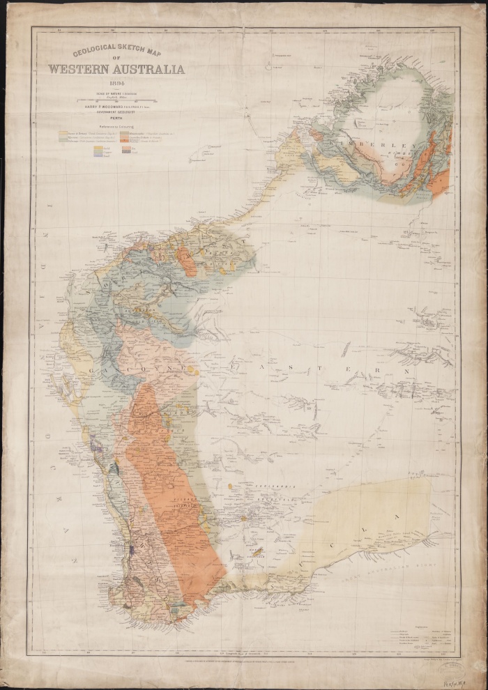
Historic maps
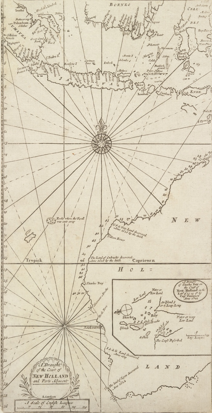
The Battye Library has many original cartographic and nautical charts by early Dutch and French explorers and the first surveys of the Swan River Colony around Australia and the southern hemisphere.
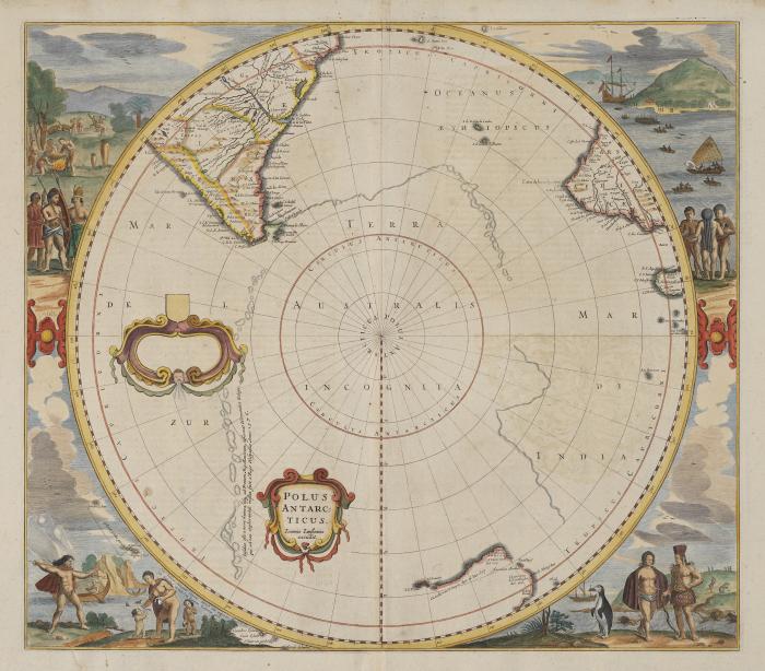
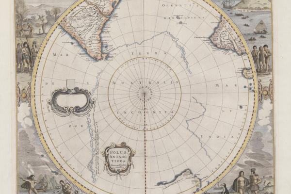
Polus Antarcticus Henricus Hondius excudi, Hendrik Hondius, 1641
Military maps
The Battye Library holds several sequences of army maps produced over the years by Australia and other countries. These are all topographic maps showing considerable infrastructure details. These maps are excellent for the sites of schools, telephone exchanges, farms, etc.
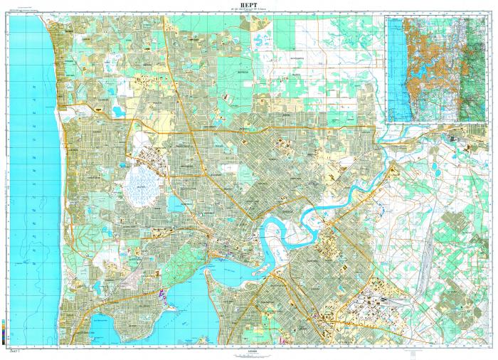
Australia Soviet military city plans, Perth South
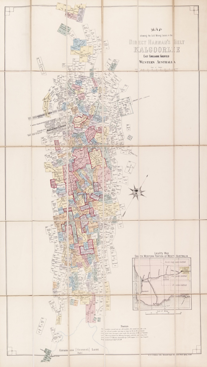
Mining lease maps
Battye Library holds a series of maps (CN7) that assist researchers looking for mining lease locations and numbers in various areas. Maps are catalogued individually and published as Mines Department 212C (list in CN7). The State Records Office also hold an index of mining leases held to individuals and companies (1892-1909).
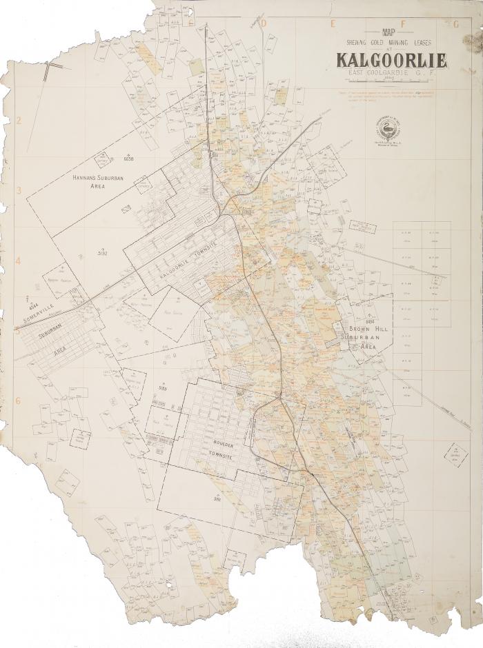
Map showing gold mining leases at Kalgoorlie, East Coolgardie Goldfields
Nautical charts
Nautical charts show coastal features, navigational aids and bathymetrical information to assist travelling around coastal Australia. The State Library collection includes charts published from the 1870s by the British Admiralty (CN73), later by the Australian Hydrographic Office and versions by WA’s Department of Transport suitable for small watercraft. These are available digitally. Scales vary chart to chart depending upon the area covered.

Australia Soviet military city plans, Perth South
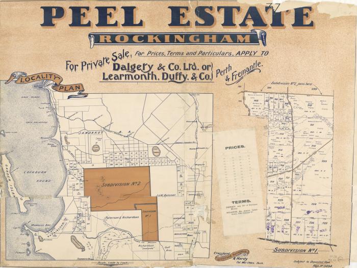
Real estate plans
The collection has approximately 1050 early real estate plans of Perth suburbs (CN1 & CN3). Many of the plans have now been catalogued and digitised. Prepared by various real estate companies between the 1890s to 1930s, the plans mainly cover the Perth metropolitan area, with some country town coverage.
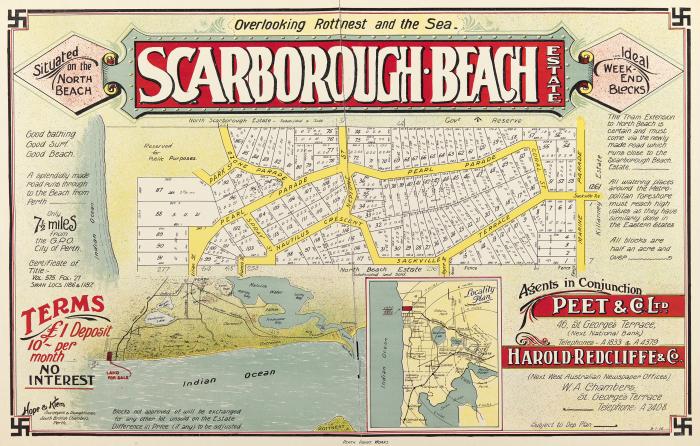
Scarborough Beach Estate, 1915
Topographic maps
Topographic maps present the horizontal and vertical positions of the features shown, using metric measurements. Produced by a Federal body, currently Geoscience Australia, formerly NATMAP, since World War 2 with coverage for the whole of Australia. There are different mapping scales produced, giving different levels of detail.
The Battye Library holds the scales of 1:1 000 000, 1:250 000, 1:100 000 and 1:50,000 for Western Australia. These have been published digitally since 2015. There are three separate records for the 1:250,000 series, each published from 1958-1996, 1996-2002 and 2006 onwards.
In March 2026, Geoscience Australia completed the nationwide release of its AUSTopo 1:250,000 digital topographic map series, putting authoritative, up‑to‑date topographic coverage of the entire country. Free to download, easy to print, and ready to use offline on mobile devices.
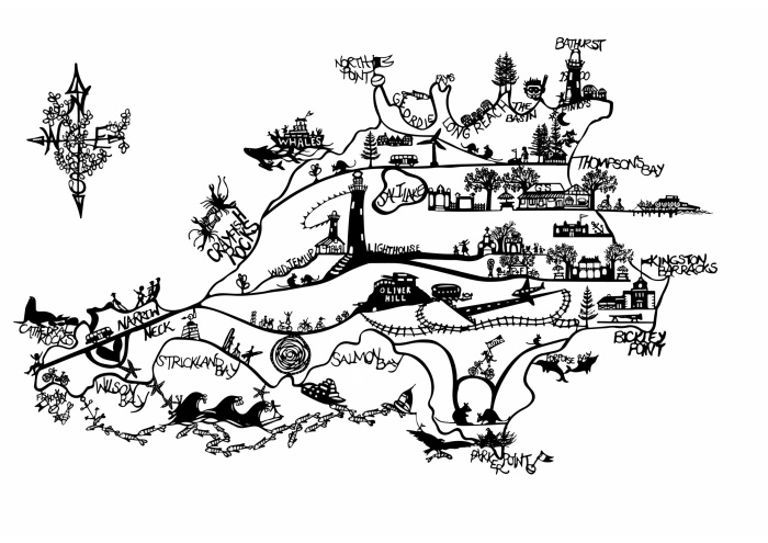
WA townsite map series
This series of maps consists of about 958 cadastral plans of various Western Australia towns from c1890 to the 1970s. They show street names, location numbers, subdivisions, reserves and town boundaries. Some towns may have an abundance of maps relating to them, others a single map.
Unlike many other series, the townsite map series have been individually catalogued. To locate a plan of a particular town, simply enter the name of the town and the word townsite in the keyword option of a map search. Map reference numbers can be located in the online catalogue.
Tools for finding and accessing WA map collections
Access to the published collection of maps and plans is via the State Library Catalogue and some card catalogues and indexes. Full holdings of map series are usually shown on index maps kept in the Library.
Dead Reckoning - Maps
Dead Reckoning has useful information on SLWA’s map collections.
Index maps
A number of the map collections have large index maps that show the full map series holdings within the State Library collections. The index maps are available on Level 3 of the State Library building and some digitised versions of index maps have been added to the catalogue record.
Cartographic notes
Cartographic Notes(CN) are library finding aids for a particular series of maps or charts and can be used in conjunction with the index maps. Digitised versions of Cartographic Notes have been added to the map series catalogue record. Some map series contain many maps and/or editions (Lands & Surveys Chain Series, Real Estate Plans, Mining Maps etc.) and so only the series has been catalogued, not each individual map. The Cartographic Notes will list all the maps in that particular series, including map number, title, publishing date and editions.
How to find a chain scale cadastral map (20, 40, 80, 300, 800 chain)
View an Illustrated Guide to Chain Map Scales
- Access the online chain series index map, or the hardcopy index map in the index map rack on the 3rd floor of the State Library
- Find the map area and chain map reference number on the index map, and note down the details, i.e., from the 80 chain references on the index map you would note down: 341 / 80
- Open the State Library online catalogue search page
- Choose title from the search index drop down menu
- In the search term box type: Western Australia Bonnes [enter chain type, i.e., 20, 40 or 80, or 300, or 800]
- In the search index collection drop down menu, select: State Library Maps
- Press the submit button. The record(s) will be found and displayed
- Search through the list until you locate the record for the specific map information you noted down, i.e. 341 / 80. If you cannot find a catalogue record for the specific map, find the general map series record, i.e. Western Australia Bonnes 80 Chain Cadastral Series (175 maps in the series)
- Open the specific map or map series catalogue record: a) If you are accessing a specific map record, i.e., Western Australia Bonnes 80 chain cadastral series 341/80, proceed to step 10, or b) If you are accessing a map series record: 1. Click view the list of items in this collection to see CN 77; 2. Use CN 77 to locate year, and other information about the required map, make a note of the details; 3. Navigate back to the map series record
- Press the request button in the button bar above the catalogue record. A Request Verification page will open.
- Enter the specific map details from the index map (or CN), i.e., 1B/20 N.W. 1953, and follow the on-screen prompts to complete your map request. If the map record does not have a request button you will need to speak to our staff and give them the key map details that you have noted. Staff will then arrange for the map you need to be retrieved from the non-public (stack) locations.
How to find historic (archival) series maps (1880 – 1900)
To access hard copies of the historic map series
- Consult the Historic Map Index in the 3rd level index map rack, or the online version via the State Records Office catalogue, to find the reference grid number that contains the point of interest, i.e., 1S
- Make a note of what information must be included in the request form, i.e., Map reference: 1S, Location: RARE 45/15-16
- Open the State Library online catalogue search page
- In the search index drop down menu, select call no.
- Enter 298c into the Search term box and select State Library from the library location drop down menu. This will retrieve the main historic map series catalogue record
- Click view the list of items in this collection to see CN 9 for further details on the historic maps, and make note of the map details you need
- Navigate back to the catalogue record
- Press the request button in in the button bar above the catalogue record. A Request Verification page will open
- Enter the map information into the request field, i.e., 1S RARE 45/15-16
To access the online copies
- Open the State Library online catalogue search page
- In the search index drop down menu, select call no.
- Type 298c into the Search term box and limit your search by selecting State Library from the library location drop down menu. This will retrieve the main historic map series catalogue record.
- Click view the list of items in this collection to see CN 9 for further details on the historic maps at which you are looking and make note of the map details you need
- Select title from the search index drop down menu
- Enter: Historic map series, Western Australia, into the Search term box and select State Library Online from the library location drop down menu. This search will retrieve a main historic map series record list showing the individual Southern (S), Central (C), Gascoyne & Kimberley (G&K), Murchison (M), and Miscellaneous (L) series records
- Select the record that includes the map area you need to view. The record will open and will display thumbnail images of each digitised map attached to it
- Scroll through the thumbnail images until you find the map that matches the details you noted down, i.e., K1 1890, and click the thumbnail image for the map. A viewing copy of the map will open
How to find real estate plans
For real estate plans on CN 1, 1.1, 3, 3.2 – 3.3 (collection: 78C, 101C – 103C, 1890 – 1930)
- Consult CN 1 – 1.1 for 78C (1890 – 1930), or CN 3, 3.2 – 3.3 for 101c – 103c (1890 – 1930) on the 3rd floor of the State Library to find the place details and the accession number for each plan, i.e., CN 1, Bay View Estate Claremont 78c
- Make a note of the place and other details of the plan you want to view
To view online copies of the plans from 78C, 101C – 103C:
- Open the State Library online catalogue search page
- Choose keyword from the search Index drop down menu
- Enter the place information from the CN, i.e., Bay View Estate Claremont 78c into the Search term box and select State Library from the library location drop down menu. An individual record or list of relevant records will appear
- Click the title of the record you want to view. The record will open and will show a thumbnail image of the plan you want to view
- Click the thumbnail image. The plan will open in a digital viewing tool
- Use your mouse to access the on-screen functions, i.e., zoom in and zoom out, and move around the plan
To view a hardcopy real estate plan from collection 78C, 101C – 103C
- Open the State Library online catalogue search page
- Choose title or keyword from the search Index drop down menu
- Enter the place information from the CN, i.e., Bay View Estate Claremont 78c, into the Search term box
- Select State Library from the library location drop down menu. An individual record or list of relevant records will appear
- Click the title of the record you want to view, and note down the item title, location, and Call Number, i.e., Bay View Estate, 3rd floor map stack, 55/18/47
- If you are in the State Library: please speak with our Librarians at the 3rd floor reference desk. The Librarians will arrange for the maps to be retrieved from the Library’s Map Stack (non-public area)
- If you are at home: please use our Ask a Librarian service to submit a map retrieval request for the map. The map(s) you want to view will to be retrieved for you to access inside the State Library building
To view a hardcopy plan from 935C (CN 60) [c1920 - 1970]
- Open the State Library online catalogue search page
- Choose title from the search Index drop down menu
- Enter: Real estate subdivisions offered for sale into the Search text box
- Select State Library from the library location drop down menu. The Real Estate subdivision record will appear
- Click view the list of items in this collection. The item list [CN 60] will open
- Search CN 60 to find and note down the details for the plan you want, i.e., Map 8, Como Heights Estate, Como c1920
- Navigate back to the Real Estate subdivision record
- Click the request button in in the button bar above the catalogue record. A Request Verification page will open
- Add the plan details from CN 60 to the special instructions box, and then click submit to send your request into the system
To view a hardcopy plan from 1076C (CN 79) [c1900 – 1910]
- Consult CN 79 on the 3rd floor of the State Library to find the Title and Call Number details for each plan, i.e., Item 2, Rosalie Estate, Subiaco. C1900-1910, 1076C/2. Note down the details of the plan
- Open the State Library online catalogue search page
- Choose call no. (call number) from the search Index drop down menu
- Enter the call no. information from CN 79, i.e., 1076C/2
- Select State Library from the Collection drop down menu and click the search button. The catalogue record for the plan will appear, i.e., 1076C/2
- Click the request button in in the button bar above the catalogue record. A Request Verification page will open
- Add any request details, i.e., date to view the map at the State Library, in the special instructions box
- Click submit to send your request into the system
How to find Darling Range road board plans
These plans are on microfilm only.
- Open the State Library online catalogue search page
- Choose title from the search Index drop down menu
- Enter Collection of land subdivision plans submitted to the Darling Range Road Board for approval into the Search term box
- Select State Library from the Collection drop down menu and click the search button. The catalogue record for the plan will appear
- Click view a list of maps in this collection to open CN 142
- Search CN 142 to find the details for each plan, i.e., 007425, Subdivision of lots 169-174 of Canning Location 3 & 11, 1923
- Go to the Microfilm room on the 3rd floor of the State Library building, to find and access the plan via the microform reader/printers. Please speak to the Librarians on the 3rd floor of the State Library building if you need assistance
How to find Post Office directory maps
- Open the State Library online catalogue search page
- Choose keyword from the search Index drop down menu
- Enter Western Australian Post Office Directory map into the Search term box
- Select State Library Maps from the Collection drop down menu and click the search button. A short list of relevant catalogue records will appear. There are three Post Office Directory maps: 1900 [online], 1901, 1915
- Click the title of the map that you want to view
- If you selected the map from 1900, the record would open and show a thumbnail image of the map you want to view
- Click the thumbnail image. The map will open in a digital viewing tool
- Use your mouse to access the on-screen functions, i.e., zoom in and zoom out, and move around the map
- If you selected the map from 1901 or 1915, the record would open
- Click the request button in in the button bar above the catalogue record. A Request Verification screen will open
- Add any request details, i.e., date to view the map at the State Library, in the special instructions box
- Click submit to send your request into the system
How to find W.A. townsite maps
- Open the State Library online catalogue search page
- Choose keyword from the search Index drop down menu
- Enter the town’s name followed by townsite, i.e., Kalgoorlie townsite into the search term box
- Select State Library from the library location drop down menu and click the search button. A list of relevant records will appear
- Click the title of the map that you want to view. The record will open.
If you selected a map record that includes a digital (online) copy of the map:
- Click the thumbnail image. The map will open in a digital viewing tool
- Use your mouse to access the on-screen functions
If you selected a map record that does not include a digital (online) copy of the map:
- The record will open
- Click the request button in in the button bar above the catalogue record. A Request Verification page will open
- Add your request details in the special instructions box, i.e., location and call number details, date to view the map at the State Library
- Click submit to send your request into the system
How to find mining lease maps
Find by title
- Open the State Library online catalogue search page
- Choose title from the search Index drop down menu
- Enter Collection of maps showing mining leases in Western Australia Index drop down menu
- Select State Library from the Collection drop down menu and click the search button. The mining lease catalogue record will appear
- Click view the list of items in this collection to access CN 7
- Search CN 7 and make a note of the required map sheet number and title details, i.e., sheet 1, mining leases at Southern Cross – Yilgarn Goldfield 1/7/1897
- Navigate back to the catalogue record
- Click the request button in in the button bar above the catalogue record. A request verification page will open
- Enter the map details into the special instructions box, and then submit the request for retrieval.
Find by area
- Open the State Library online catalogue search page
- Choose subject from the search Index drop down menu
- Enter mining leases into the Search text box
- Select State Library Maps from the Collection drop down menu
- Click the search button. A list of relevant mining lease catalogue records will appear
- Browse the list for the area of the required mining lease, i.e., mining leases Western Australia Boulder Maps
- Click the relevant record or list of records to navigate to the mining lease you want to view.
If the mining lease is online:
- The thumbnail image of the map you want to view will appear within the record
- Click the thumbnail image. The map will open in a digital viewing tool
- Use your mouse to access the on-screen functions, i.e., zoom in and zoom out, and move around the map
If the mining lease map is not online:
- The record will open
- Click the request button in in the button bar above the catalogue record. A request verification page will open
- Add your request details in the special instructions box, i.e., date to view the map at the State Library
- Click submit to send your request into the system
How to find mining lease holders
Please see Dead Reckoning’s lease holder information page for details. Also check out Combined index to the publications of the Geological Survey of Western Australia 1910-1970 Q016.6221 BRI. This reference contains useful information on mining centres, individual mines, and leases. The annual progress report for the Geological Survey for the year… [Geological Survey of W.A.] 559 GEO, is also a useful resource.
How to find aerial photographic maps
- Open the State Library online catalogue search page
- Choose keyword from the Search Index drop down menu
- Enter aerial into the Search text box. Alternatively, try a subject search using [placename] (W.A.) – Aerial photographs, i.e., Perth (W.A.) – Aerial photographs, or Military topography -- Western Australia.
- Select State Library Maps from the Collection drop down menu
- Click the search button. A list of relevant aerial catalogue records or subject headings will appear
- Search through the list until finding a relevant catalogue record
- Click the catalogue record title to access the record
If the aerial photograph(s) is online:
- The thumbnail image of the photograph will appear within the record
- Click the thumbnail image. The map will open in a digital viewing tool
- Use your mouse to access the on-screen functions
If the aerial photograph(s) is not online:
- The record will open
- Click the request button in in the button bar above the catalogue record. A request verification page will open
- Add your request details in the special instructions box, i.e., date to view the map at the State Library
- Click submit to send your request into the system
How to find army topographic maps
1. For maps 1” = 1 mile (1919-1957): CN 15 (Ex ACC 433C)
- Open the State Library online catalogue page
- Choose keyword from the Search Index drop down menu
- Enter military survey CN 15 into the search text box
- Select State Library from the Collection drop down menu and click the search button. The map record will appear
- Click View the list of items in this collection. CN 15 will appear
- Search CN 15 to see if the State Library holds the required map
- Make a note of the sheet name, number, grid number & date of the required map, i.e., Adolphus Island, 2090, D/52-14-34, 4/1944
- Navigate back to the collection record
- Click the request button in the button bar along the top of the collection record. A request verification page will appear
- Add the map and request details in the Special Instructions box, i.e., Adolphus Island, 2090, D/52-14-34, 4/1944, date required: 23 August 2022 11:00am
- Click submit to send your request into the system
2. For maps 1” = 4 miles (1941 – 1957): CN 16/1 ACC 434C
- For maps 1” = 4 miles (1941 – 1957): CN 16/1 ACC 434C
- Open the State Library online catalogue page
- Choose keyword from the Search Index drop down menu
- Enter military survey CN 16 into the search term field
- Select State Library from the Collection drop down menu
- Click the search button. The records for CN 16/1 & CN 16/2 will appear
- Select the record for CN 16/1
- Click view the list of items in this collection. CN 16/1 will appear
- Search CN16/1 to see if the State Library holds the required map
- Make a note of the map name, sheet number, grid number & date of the required map, i.e., Ajana, -, G/50-13, 1943
- Navigate back to the collection record
- Click the request button in the button bar along the top of the collection record. A request verification page will appear
- Add the map and request details in the special instructions box, i.e., Ajana, -, G/50-13, 1943, date required: 23 August 2022 11:00am
- Click submit to send your request into the system
3. For maps 1” = 8 miles (1942 – 1944): CN 16/2 ACC 435C
- Open the State Library online catalogue page
- Choose keyword from the Search Index drop down menu
- Enter military survey CN 16 into the search term field
- Select State Library from the Collection drop down menu
- Click the Search button. The records for CN 16/1 & CN 16/2 will appear
- Select the record for CN 16/2
- Click view the list of items in this collection. CN 16/2 will appear
- Search CN16/2 to see if the State Library holds the required map
- Make a note of the sheet name, sheet number, & date of the required map, i.e., Balladonia, I/51-3, 4, 7, 1942
- Navigate back to the collection record
- Click the request button in the button bar along the top of the collection record. A request verification page will appear
- Add the map and request details in the special instructions box, i.e., Balladonia, I/51-3, 4, 7, 1942, date required: 23 August 2022 11:00am
- Click submit to send your request into the system
How to find Admiralty (nautical) charts
- Open the State Library online catalogue page
- Choose title from the Search Index drop down menu
- Enter Western Australia Admiralty Charts into the search term box
- Select State Library from the Collection drop down menu
- Click the search button. The Admiralty charts record will appear
- Click view the list of items in this collection. CN 73 will appear
- Search CN 73 to see if the State Library holds the required chart
- Make a note of the chart number, title, & date, of the required chart, i.e., Depuch Island Anchorage and approaches, 1909
- Navigate back to the collection record
- Click the request button in the button bar along the top of the collection record. A request verification page will appear
- Add the map and request details in the special instructions box, i.e., Depuch Island Anchorage and approaches, 1909, date required: 23 August 2022 11:00am
- Click submit to send your request into the system
How to find maps in rare books
All rare items may only be accessed by registered members of the State Library within the Leah Jane Cohen Reading Room on the 3rd floor of the State Library building. If the rare books are digitised, you will be able to access them via the State Library catalogue. If necessary, please speak with Library staff to view the hardcopy of the rare books.
- Visit the 3rd floor of the State Library and consult CN 150
- Locate the required map within CN 150, and note the details of the book in which the map is included
- Open the State Library online catalogue page
- Choose title from the Search Index drop down menu
- Enter the book title details into the search term box
- Select State Library from the Collection drop down menu
- Click the search button. The record for the book will appear
- If the book is not online, click the request button in the button bar along the top of the collection record. A request verification page will appear
- Add your request details in the special instructions box, i.e., date required: 23 August 2022 11:00am
- Click submit to send your request into the system
How to find maps in rare pamphlets
All rare items may only be accessed by registered members of the State Library in the Leah Jane Cohen Reading Room on the 3rd floor of the State Library building. If the rare pamphlets are digitised, you will be able to access them via the State Library catalogue. If necessary, please speak with Library staff to view the hardcopy of the rare pamphlets.
- Visit the 3rd floor of the State Library and consult CN 160
- Locate the required map within CN 160, and note the details of the pamphlet in which the map is included
- Open the State Library online catalogue page
- Choose title from the Search Index drop down menu
- Enter the pamphlet title details into the search term box
- Select State Library from the Collection drop down menu
- Click the search button. The record for the pamphlet will appear
- Click the request button in the button bar along the top of the collection record. A request verification page will appear
- Add your request details in the Special Instructions box, i.e., date required: 23 August 2022 11:00am
- Click submit to send your request into the system
How to find NATMAPS, Defence, and Department of Lands and Surveys (DOLA) maps
NATMAPs was the original company now published by Geoscience Australia. The State Library holds most NATMAPs for W.A. Various map series exist: DOLA 1:25 000 (Series R812), Defence 1:50 000 (series R712), Defence 1:100 000 (series R611), NATMAPs 1:100 000 series, 1:250 000 series, 1:1 000 000 series. Where available, links to online versions of the index maps are provided below.
1. For Hardcopy and online index maps
- Consult the index map(s) and note the specific map reference numbers for the maps you want to view. The index maps for all these series can be found in the index map rack on the 3rd floor of the State Library building.
- Consult the Defence index map for 1:50 000 (online version available from Geoscience Australia), or the Western Australia index map produced by the W.A. Dept. of Lands and Surveys (online version available from Landgate) ; or
- Consult the old or new series NATMAP indexes for 1:100 000, 1:250 000, 1:1 000 000 map series (online versions available from Geoscience Australia: 1:100 000, 1:250 000, 1:1 000 000)
2. For Defence 1:50 000 (Series R712) maps or Landgate/DOLA 1:50 000 maps
- Using the 1:50 000 Defence index map, or the Landgate/DOLA (Western Australia) index map, find and make a note of the name, and the Defence or DOLA map number, for the map area you need, i.e., 2033-2034 [Defence grid reference for Perth], Wedge Island 1936-3 [Landgate/DOLA grid reference for Wedge Island]
- Open the State Library online catalogue page
- Choose keyword from the Search Index drop down menu
- Enter defence (or Western Australia) topographic 1:50 000 into the search term box, i.e., defence topographic 1:50 000
- Select State Library maps from the Collection drop down menu
- Click the search button. A list of relevant catalogue records will appear
- From the result list select the record that matches your search terms, i.e. Australia 1:50000 topographic survey Western Australia
- Click the request button in the button bar along the top of the collection record. A request verification page will appear
- Add your request details in the Special Instructions box, i.e., Wedge Island 1936-3, date required: 23 August 2022 11:00am
- Click Submit to send your request into the system
3. For NATMAP 1:100 000 maps, or NATMAP 1:250 000 maps, or NATMAP 1:1 000 000 maps
- Open the State Library online catalogue page
- Choose title from the Search Index drop down menu
- Enter NATMAP topographic 1:100 000, or 1:250 000, or 1:1 000 000 (dependent on which map scale you need) into the search term field, i.e, NATMAP topographic 1:100 000 series, Western Australia
- Select State Library maps from the Collection drop down menu
- Click the search button. The relevant catalogue record(s) will appear
- Click the request button in the button bar along the top of the collection record. A request verification page will appear
- Add your request details in the Special Instructions box, i.e., 2034 Perth, date required: 23 August 2022 11:00am
- Click submit to send your request into the system
How to find Australian nautical charts
- Consult the Australian nautical chart index map on the 3rd level index map rack, or the online Australian nautical chart index on Trove
- Find the AUS chart reference number for the required area, i.e., AUS 112
- Open the State Library online catalogue page
- Choose keyword from the Search Index drop down menu
- Enter the chart number for the chart into the search term field, i.e., AUS 112
- Select State Library maps from the Collection drop down menu and
- Click search. The relevant catalogue record(s) will appear.
If the relevant catalogue record(s) for the chart appears:
- Click the title of the record. The record will open
- Click the request button in the button bar along the top of the collection record. A request verification page will appear
- Add your request details in the Special Instructions box, i.e., AUS 112 Approaches to Fremantle, date required: 23 August 2022 11:00am
- Click submit to send your request into the system.
If the relevant catalogue record for the chart does not appear:
- Choose title from the Search Index drop down menu
- Enter Hydrographic charts of Australian, Papua New Guinean and Antarctic waters into the search term box
- Select State Library maps from the Collection drop down menu
- Click the search button. The hydrographic charts catalogue record will appear
- Click the request button in the button bar along the top of the collection record. A request verification page will appear
- Add your request details in the Special Instructions box, i.e., AUS 112 Approaches to Fremantle, date required: 23 August 2022 11:00am
- Click submit to send your request into the system.
Map highlights
Maps and charts
WA history
The map was designed and engraved by the Nuremberg cartographer Philip Eckebrecht at the request of his friend Johannes Kepler. The map was intended to illustrate his Rudolphine Tables, used to more precisely calculate the positions of the moon and the known planets.
Maps and charts
WA history
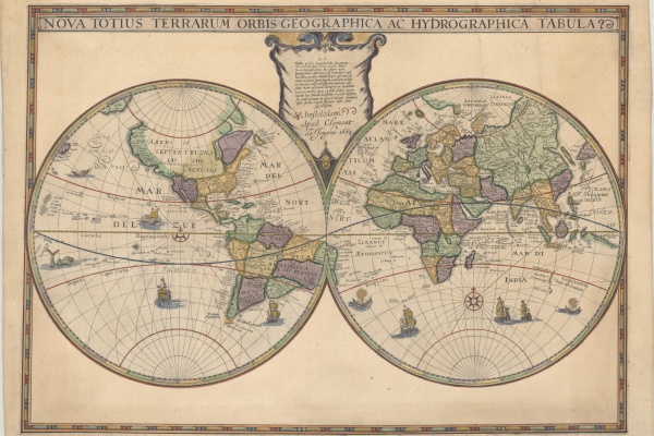
A new addition to the State Library collection, the Hondius World Map by Jodocus Hondius the younger (1594 – 1629) is the earliest printed map to show the recent Dutch explorations on the West Coast of Australia.
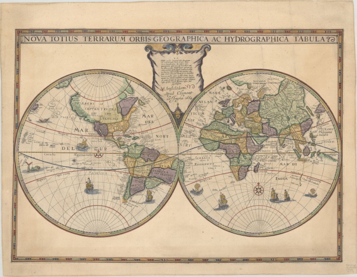
A map in four states plus one
Stories
Maps and charts
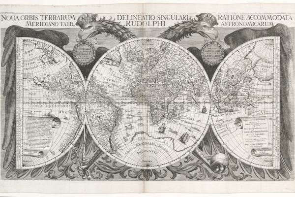
The State Library has five editions of a hemispherical map centred on the South Pole. These show southern parts of South America and South Africa and the west and south coasts of Australia.
WA Bonnes 80 chain cadastral maps
Maps and charts
WA history
The Preservation Team has recently completed digitising the Western Australia Bonnes 80 chain cadastral series of maps covering most of the lower third of Western Australia and showing land boundaries from approximately 1896-1984.
Gallipoli 1915 & Ypres 1917
ANZAC stories
Maps and charts
WA history
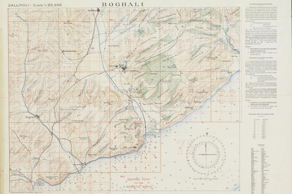
In 1915 and 1917, our historical maps of Gallipoli and Ypres were working documents. Paying attention to them could be the difference between a soldier writing home or someone else writing to their family.

Letters, stories, maps and cigarette cards
ANZAC stories
Maps and charts
SLWA on ABC Radio
WA history
Peter Edwards, Heritage Team Librarian, discusses original ANZAC materials from the State Library archives.
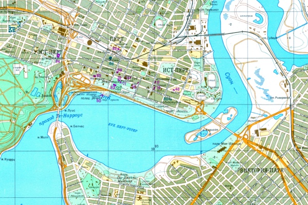
Spy Maps
Stories
Maps and charts
WA history
The Red Atlas details the story of how the Soviet Army used spies to conduct a global topographic mapping program from 1950 to 1990 with astonishing detail that supported a full range of military planning.
Spy Maps
ANZAC stories
Maps and charts
WA history
A rare album relating to the Japanese Imperial Army's plan to invade Australia and New Zealand during World War II.


Map eResources
Mapping the World: Maps and Travel Literature Archive presents unique insight into the age of cartography and the rise of leisure travel during the nineteenth century, including a myriad of sketch map
Age of Exploration Archive covers five centuries of journeys across the globe, scientific discoveries, the expansion of European colonialism, conflict over territories and trade routes, and decades-lo