Source of curated content from Australian, New Zealand and International sources covering important issues relating to Australia and New Zealand. Featuring authoritative and continuously upda
NationalMap is an online map-based tool. It allows easy access to spatial data from Australian government agencies. Various datasets can be overlaid and explored on the map.
The Historical Aerial Photography collection tracks the use and development of land. It is a helpful way of locating places in Australia from 1928 to the present.
Map Search allows layering of various historical Australian maps over current maps. It provides an interactive way of exploring how places have changed over time.
First Languages Australia promotes Aboriginal and Torres Strait Islander languages. The site contains educational resources including an interactive languages map.
The National Archives of Australia collects, preserves and provides access to Government records. Many records are available online for professional research or personal interest.
AusGIN provides Australian geological and geophysical data. It also gives information about mineral resource exploration.
The Biodiversity Heritage Library contains many books and archives on global biodiversity. Full text of rare and early publications relating to Western Australia is available.
Australian Indigenous HealthInfoNet provides current information about Aboriginal health and healthcare. It also links to relevant policies and programs on the topic.
The Australian Bureau of Statistics collects and analyses statistics for the Australian government. They publish statistical information including census data.
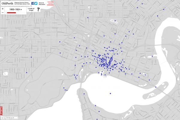
Navigate through space and time with the OldPerth project created in cooperation with Curtin University HIVE.
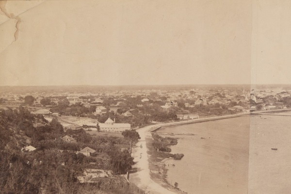
Historical Panoramas features panoramic photographs of Perth and Fremantle. These panoramas show how Perth has developed over a period of more than 150 years.