Image
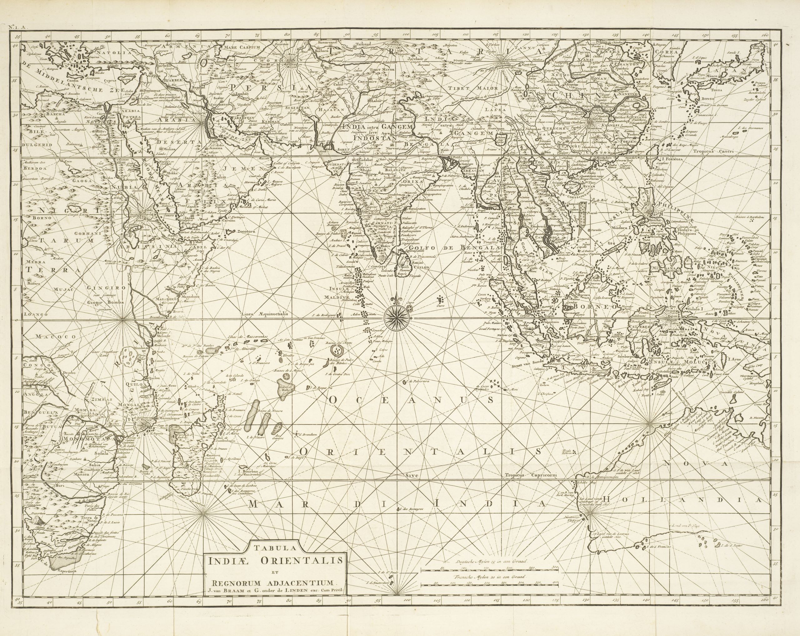
Tabula Indiæ Orientalis et regnorum adjacentium
Overview map from Valentijn's Oud en niuew Oost-Indien, showing the eastern Mediterranean to Africa, Australia to Japan. Depicts the outlines of the western two-thirds of Australia, based on the discoveries of explorers working for the Dutch East India Company (the VOC). These include Willem Jansz's discoveries in the Gulf of Carpentaria in 1606; the encounters of Dirk Hartog in 1616, the crew of the Leeuwin in 1622, Gerrit Frederiksz de Witt in 1627, and Pieter Nuyts in 1627, in Western Australia; and Jan Cartensz and Willem van Colster's discoveries in Northern Australia in 1623.
Overview map from Valentijn's Oud en niuew Oost-Indien, showing the eastern Mediterranean to Africa, Australia to Japan. Depicts the outlines of the western two-thirds of Australia, based on the discoveries of explorers working for the Dutch East India Company (the VOC). These include Willem Jansz's discoveries in the Gulf of Carpentaria in 1606; the encounters of Dirk Hartog in 1616, the crew of the Leeuwin in 1622, Gerrit Frederiksz de Witt in 1627, and Pieter Nuyts in 1627, in Western Australia; and Jan Cartensz and Willem van Colster's discoveries in Northern Australia in 1623.
State Library of Western Australia slwa_b6791554_2
Plate No. 1 A from: Oud en nieuw Oost-Indien ... / door Francois Valentyn. Te Dordrecht ; Amsterdam : Joannes van Braam, Gerard onder de Linden, 1724.
Plate No. 1 A from: Oud en nieuw Oost-Indien ... / door Francois Valentyn. Te Dordrecht ; Amsterdam : Joannes van Braam, Gerard onder de Linden, 1724.