Long before we could access satellite imagery, we relied upon hand-drawn maps to navigate—the greater the detail, the greater the information that one could use. The Red Atlas is the story of how the Soviet Union secretly mapped the world in astonishing detail from 1950 to 1990.
“Spying involves waiting, watching, remembering, and recording. It involves sophisticated cameras and high-altitude aircraft and missiles with satellites, but also people on the ground, quietly walking down streets, looking.
Sometimes, the products of all that spying during the Cold War were intelligence reports, which told Washington or London or Moscow what the other side was doing. Intelligence reports might provide inside information that could be used to decide broad strategy- when to move armies or navies.
Sometimes, the products were maps. Highly detailed maps, useful for spies and policy makers, for diplomats, invading armies and occupiers. Maps that could provide more specific tactical information that might come from intelligence reports. Maps that could tell a general which roads and bridges provide the best routes to use to drive his tanks, or an admiral which harbours were deep enough for his destroyers.” -
From The Red Atlas: How the Soviet Union secretly mapped the world by John Davies, Alexander J. Kent, and James Risen. Published by the University of Chicago Press, 2017.
The State Library has acquired a few items over time for the Heritage collections that would fall into this category. It is interesting to look at these retrospectively and consider how they may have been used or interpreted.
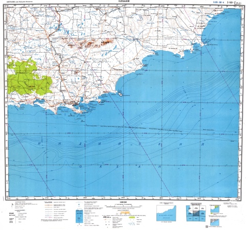
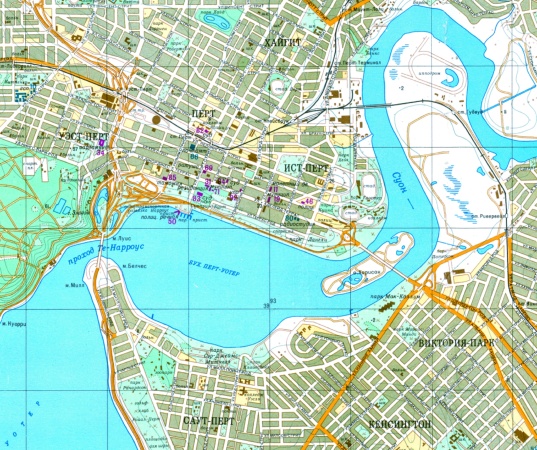
The above is a section from one of the two larger scale maps covering the Perth metro area. You can see the detail and volume of information that may be of useful to someone with a greater understanding of military tactics. Also, the colours used to help clearly differentiate the land from the water and the built-up areas compared to the parks and open areas.
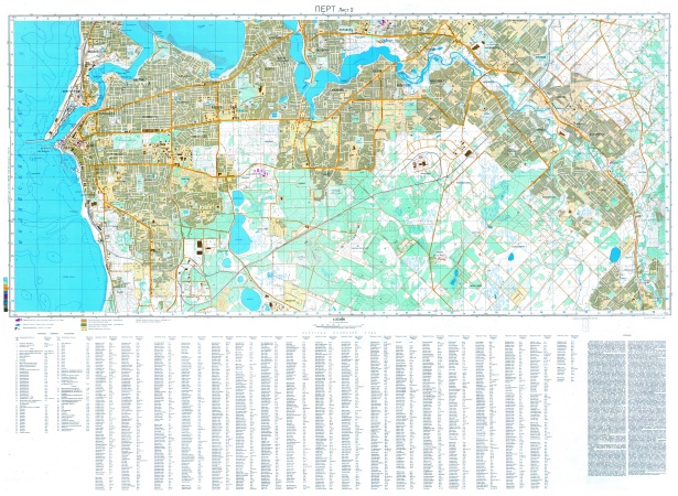
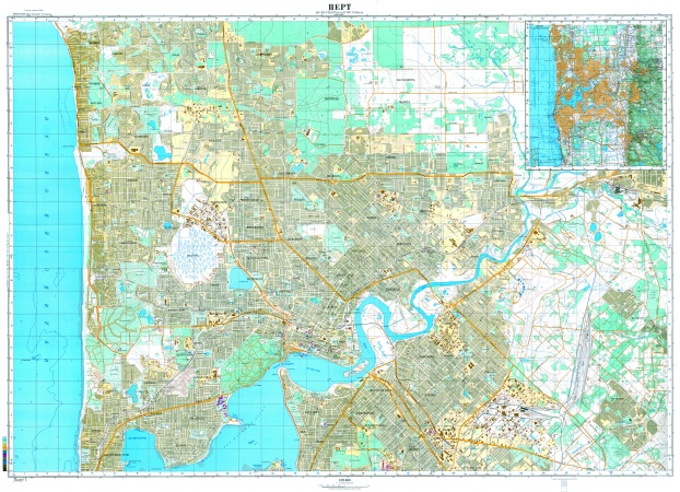
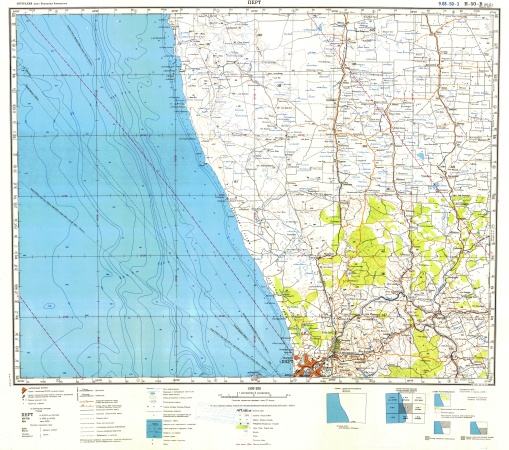
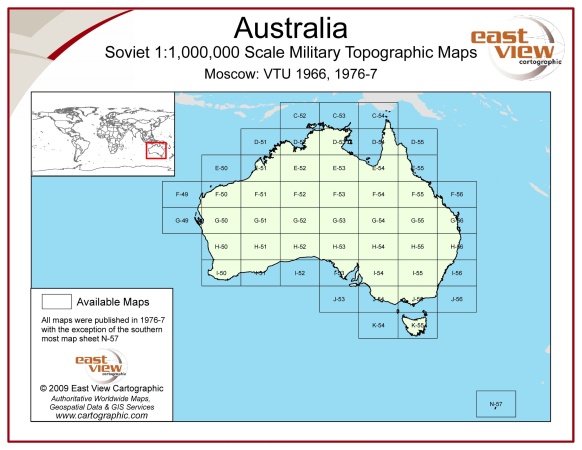
The State Library also has two other series of Soviet military maps of different scales both physical (in hardcopy) and digitally through the catalogue. The 1:1,000,000 and 1: 500,000 scales series maps cover the entire state of Western Australia with information mainly from the 1970’s.
Discover more...
The State Library aims to collect a copy of every map and chart produced in Western Australia and is a legal deposit library for all Government and private publishers.
Spy Maps
ANZAC stories
Maps and charts
WA history
A rare album relating to the Japanese Imperial Army's plan to invade Australia and New Zealand during World War II.
Maps and charts
WA history
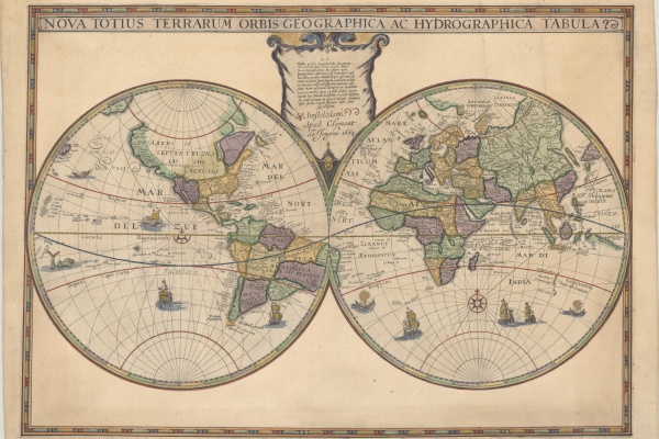
A new addition to the State Library collection, the Hondius World Map by Jodocus Hondius the younger (1594 – 1629) is the earliest printed map to show the recent Dutch explorations on the West Coast of Australia.
Topic