Image
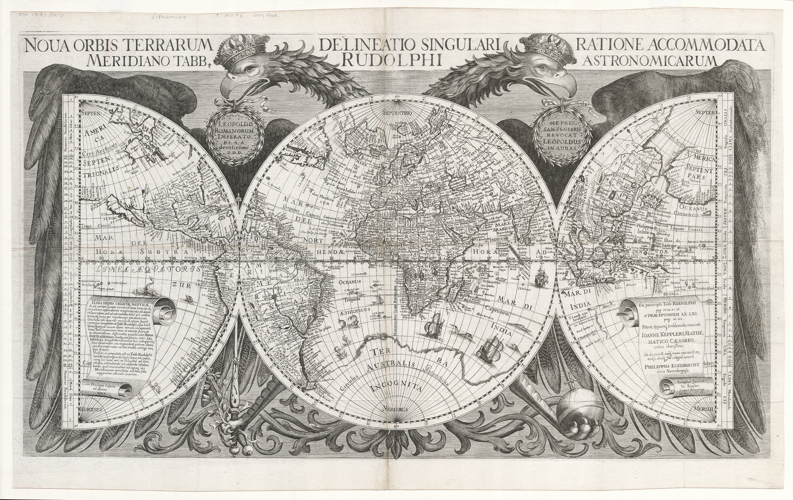
In 2022 the State Library acquired this rare and significant early map of the world dated 1658. Designed and engraved by Nurenberg cartographer Philip Eckebrecht at the request of his friend the astronomer Johannes Kepler, this map is special because it is the first to show Kepler’s calculations in Latin for the position of the moon and planets and allows the calculation of longitude. This was a significant development that assisted more accurate navigation across the oceans and opened up trade and colonisation. This map shows the most up to date information on the Dutch mapping of the West Australian coast, which can be seen in the bottom right corner as a fragment of the coastline. The map’s German Imperial double-headed eagle holds the world in its wings, an allegory of the imperial protection of Rudolf II Holy Roman Emporer, who sponsored Kepler’s research.
State Library of Western Australia MAPR0000420; Eckebrecht, Philip, 1594-1667, cartographer