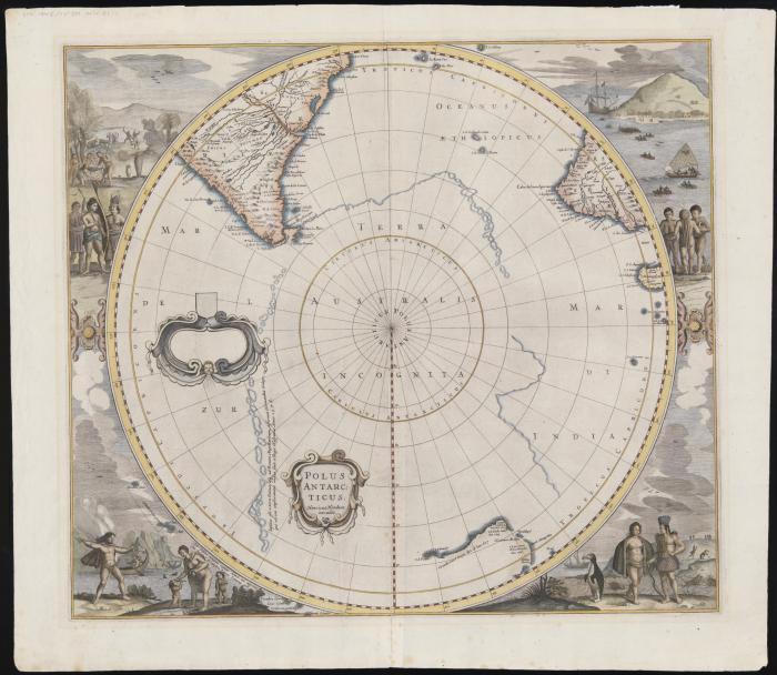
Polus Antarcticus first state
This is an example of the first state of the map showing Australia predating the first appearance of New Zealand and Van Dieman's Land. The supposed coastline of the unknown southern continent continues to appear. Detail around Western Australia showing t' Lant van P. Nuyts discovered in January 1627, Edel's Lant discovered in 1619, Eendrachts discoveries in 1616, as well as notes mentioning Williams Renier and Dirck Hertogs Ree and several other place names and early contacts prior to the discoveries of Tasman in 1642 and 1643-44.
The State Library has five states or editions of the map, “Polus Antarcticus” in the Heritage collection. A hemispherical map within a square frame, centred on the South Pole to the Tropic of Capricorn, 23° south, showing southern parts of South America and South Africa and the west and south coasts of Australia.
The not fully explored Polar continent is delineated partly by island chains and partly by line. At the centre of the map are the words Terra Australis Incognita. The sheet corners are filled in with large vignettes of native scenes including animals, birds, boats and a representation of a penguin.
First published by Dutch cartographer and engraver, Henricus Hondius, around 1637 and subsequently by Jansson, De Wit, Gerard Valk and Pieter Schenk in four varying states over a period of sixty years. “Polus Antarcticus” was originally published as a map in various Dutch, Latin, French and German editions of Mercator’s “Atlantis Majoris” atlas. Many copies have been separated from their source atlases, and hand coloured. Although it is believed some later editions may have been printed and published separately. The different states are a result of a number of factors, some are cosmetic as new cartographers were able to access the copper printing plate of the map and added details including their cartouche, or title shield. As more information returned from the Dutch explorers and traders, it resulted with changes to the land masses adding to the accuracy of the “drawn” world. Example of this around the newly discovered Australian coast with Tasmania added the Fourth State of the map.

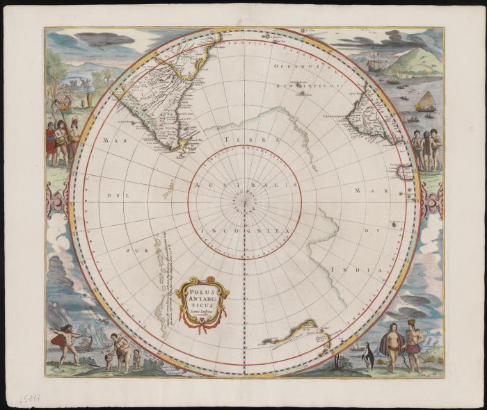
Polus Antarcticus second state
This is an example of the second state which lists "Ioannes Iansonnius" as the publisher in the title cartouche.
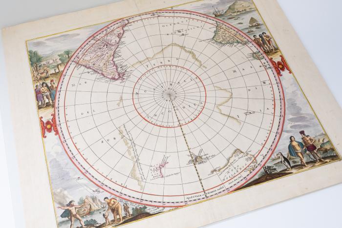
Polus Antarcticus third state
This is an example of the third state which also lists "Ioannes Iansonnius" as publisher but omits the blank cartouche, and includes several discoveries not present on the first or second states of the map.

Polus Antarcticus fourth state
The fourth state of Polus Antarcticus was first published in 1652. It omits the title cartouche and includes further new discoveries including parts of New Zealand and Tasmania.
Polus Antacticus fourth state ( 1700 version)
This 1700 version of the fourth state is without text on the back but has the imprint “Apud G. Valk et P. Schenk Amstel
Topic