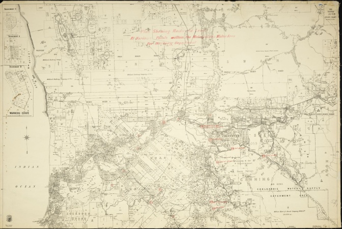
The State Library of Western Australia's Preservation Team has recently completed digitising the Western Australia Bonnes 80 chain cadastral series of maps. The 80 chain are a highly requested series of maps to view in the Reading Room by researchers and family history clients as they show land boundaries. 923 individual maps have been digitised of this series, from 1896-1984 and now available to view online.
Around the turn of the 19th century, an all embracing mapping system for medium, large and smaller scale cadastral coverage of the whole territory of Western Australia was developed. It was constructed on the Bonne Modified Conical projection.
This mapping system was to serve the State well. It was displaced by the post-World War II national and international shift to the Universal Transverse Mercator projection with the adoption of the International Map Grid (Australian National grid version).
One chain is 22 yards or 20 metres or the length of a standard cricket pitch. The basic unit of the mapping system was the 1 mile or 80 chains to 1 inch (metric 1:63 369) sheet. Sheet lines were completely systematised, except for a separate grid, which was introduced for the area of the Kimberley.
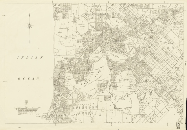
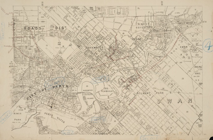
Where the density of settlement and the resulting degree of land alienation demanded, the basic 80 chain sheet was divided into four quadrants to form the 40 chain sheets (metric 1:31 680), A, B, C and D starting in the top left corner and moving clockwise. These could be further subdivided into four sub-quadrants for areas of high density, NE, NW, SW and SE, such as the growing Perth Metropolitan region. Thus, a 20 chain (metric 1:15 840) series was created and used for Public Plans in 1925.
The title of each map consists of a numerical symbol followed by a slash “/” and scale 80, 40, 20 etc.
Eg. 1/80, 1D/40. This may appear on the lower border of the map and can be used to search the catalogue to find copies of the maps.
These maps were used as the base maps for multiple Government Agencies for the period and updated from time to time when information changed. The State Library has digitised all our copies of maps from the cadastral series, including different editions from about 1905 to the late 1950s. These show the boundaries of land, often with areas of individual land parcels for describing ownership. These maps may also depict other features relating to land use and value. Together, these will show how Western Australia has developed over this period. The 80 chain series covers most of the lower third of Western Australia, stretching from Geraldton in the North to Esperance in the South, with a few additional maps covering Kalgoorlie, Leonora, Carnarvon and Roebourne. The index map for the Chain series has also been digitised and can be found searching “chain index map” on the catalogue or the physical copy in the 3rd Floor map storage.
Until the late 1920s, it was common for Indigenous names for many towns and features around the State to be included on the maps, but after this, these were removed.
On the other hand, where the density of occupation did not warrant it, 300 chains to 1 inch ( metric 1:237 600) sheets or 240 chains to 1 inch were used. In the desert, or semi-desert of WA, where occupation is the exception rather than the rule, use was made of 800 chain sheets (metric 1:633 600). These have yet to be digitised to date.
Discover more about the State Library's collection of Maps, Plans and Charts.

Discover more...
The State Library aims to collect a copy of every map and chart produced in Western Australia and is a legal deposit library for all Government and private publishers.
Maps and charts
WA history
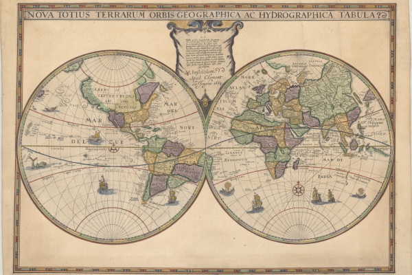
A new addition to the State Library collection, the Hondius World Map by Jodocus Hondius the younger (1594 – 1629) is the earliest printed map to show the recent Dutch explorations on the West Coast of Australia.
A map in four states plus one
Stories
Maps and charts
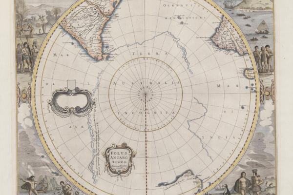
The State Library has five editions of a hemispherical map centred on the South Pole. These show southern parts of South America and South Africa and the west and south coasts of Australia.
Topic